Big melt coming this weekend in Okanagan, Kamloops
The short blast of Arctic air that brought cold and snow to the Thompson and Okanagan regions overnight will be followed by warm temperatures on the weekend that should melt a good bit of the snow covering the ground. But, first, there’s a chance of as much as four centimetres of...
 Valandos
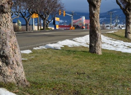
The short blast of Arctic air that brought cold and snow to the Thompson and Okanagan regions overnight will be followed by warm temperatures on the weekend that should melt a good bit of the snow covering the ground.
But, first, there’s a chance of as much as four centimetres of snow tomorrow, Feb. 4, before the warmer temperatures arrive.
Environment Canada calls for two to four cm of snow in the Kelowna and Vernon areas starting in the morning, light snow in Kamloops and two cm in Penticton.
Then weekend temperatures are forecast in the 4 Celsius to 5 C range in the Okanagan over the weekend before hitting 7 C on Monday, with mostly sunny skies.
The weekend forecast for Kamloops is for highs of only 3 C on the weekend under sunny skies then hitting 7 C to 9 C into next week.
READ MORE: What Kamloops and Okanagan honey bees do during winter
Travel through the mountain passes could be tricky with a 40% chance of flurries today, possibly changing to freezing rain this evening on the Coquihalla Highway from Hope to Merritt.
Friday could see 5 C of snow on the highway changing to rain as snow levels rise to 1,200 metres in the afternoon.
Travel should be better from Merritt to Kamloops with a 40% chance of flurries this morning turning to cloudy skies tonight and about two cm of snow Friday ending early in the afternoon.
The Okanagan Connector has a 60% chance of flurries this morning and gusty winds through the night. There could be two to 4 cm of snow Friday morning.
The chance of flurries on Highway 3 from Hope to Princeton rises to 70% tonight from 40% this morning. There’s a chance of freezing drizzle this evening and 2 to 4 cm Friday with gusty winds.
Alpine snow base on regional ski hills:
- 202 cm – Sun Peaks
- 161 cm – Silver Star
- 178 cm – Big White
- 164 cm – Apex
To contact a reporter for this story, email Rob Munro or call 250-808-0143 or email the editor. You can also submit photos, videos or news tips to the newsroom and be entered to win a monthly prize draw.
We welcome your comments and opinions on our stories but play nice. We won't censor or delete comments unless they contain off-topic statements or links, unnecessary vulgarity, false facts, spam or obviously fake profiles. If you have any concerns about what you see in comments, email the editor in the link above.