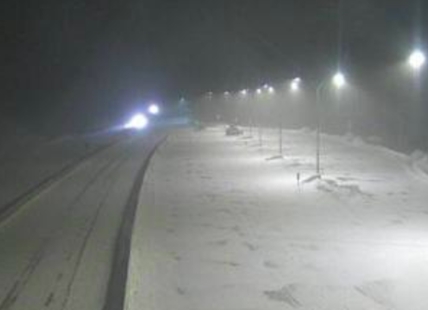
iN TRAFFIC: Expect terrible driving conditions on Thompson-Okanagan roadways
Snowfall warnings continue today, Dec. 20, for the Coquihalla Highway, Highway 3 from Hope to Princeton and the South Okanagan with snowfall accumulation of up to 20 cm in some areas. “A low pressure system will move through Washington State today,” the Environment Canada warning...
 Valandos
Snowfall warnings continue today, Dec. 20, for the Coquihalla Highway, Highway 3 from Hope to Princeton and the South Okanagan with snowfall accumulation of up to 20 cm in some areas.
“A low pressure system will move through Washington State today,” the Environment Canada warning says. “The associated front will brush the very southern part of British Columbia, giving a round of snow this morning through late this afternoon.”
Weather warnings, either for snow, storms or cold, cover most of the province.
The worst parts of the Coquihalla Highway, according to DriveBC start 6 km south of the Great Bear Snowshed and continue through Kamloops.
Even so, current weather conditions in the Lower Mainland show snow and blowing snow so expect snow throughout the region.
“Be prepared to adjust your driving with changing road conditions,” the weather warning says. “Surfaces such as highways, roads, walkways and parking lots may become difficult to navigate due to accumulating snow. If visibility is reduced while driving, turn on your lights and maintain a safe following distance”
The Environment Canada Travellers Forecast page calls for 10-15 cm on the Coquihalla Highway from Hope to Merritt with high temperatures of -22 Celsius. The snow should ease to a 60% chance of flurries this evening but with gusty winds and a low of -30 C.
Only 5 cm of snow are expected from Merritt to Kamloops with gusty winds and highs of -25 C. It should clear this evening but gusty winds are still expected with lows of -30 C.
The Okanagan Connector is expecting 5-10 cm of snow, gusty winds with a high of -21 C. It should clear this evening but winds will continue and the low overnight is forecast to be -34 C.
Highway 3 from Hope to Princeton may get as much as 20 cm of snow with a high of -19 C and gusty winds. It should clear before morning with lows of -28 C.
Highway 1 from Eagle Pass to Rogers Pass is forecast to only get 2-4 cm of snow, beginning this morning with a high of -25 C. The snow should end this evening with an overnight low of -32.
Penticton, being closer to the storm front, could get 5-10 cm of snow through this afternoon. Winds could gust to 50 km/h with a wind chill near -25 C even though the daytime high is forecast to be -12 C.
Similar snow and wind conditions are forecast for Kelowna and Vernon with daytime highs of -15 C and overnight lows of -24 C to -26 C.
Kamloops is forecast to get only 2-4 cm of snow, ending near noon but winds gusting up to 50 km/h could drop the wind chill factor to -36 C. Today’s high temperature is forecast to be -20 C with an overnight low tonight of -29 C.
No new snow has been recorded at Sun Peaks Ski Resort in the last 48 hours, leaving an alpine base of 91 cm. It’s -21 C.
Silver Star Mountain Resort is -18 C with 2 cm of new snow, giving an alpine base of 119 cm.
Big White Ski Resort has 4 cm of new snow in the last 24 hours, has an alpine base of 103 cm and a temperature of -22 C.
Apex Mountain Resort sits at -26 C with 5 cm of new snow in the last 24 hours and an alpine base of 126 cm.
To contact a reporter for this story, email Rob Munro or call 250-808-0143 or email the editor. You can also submit photos, videos or news tips to the newsroom and be entered to win a monthly prize draw.
We welcome your comments and opinions on our stories but play nice. We won't censor or delete comments unless they contain off-topic statements or links, unnecessary vulgarity, false facts, spam or obviously fake profiles. If you have any concerns about what you see in comments, email the editor in the link above.