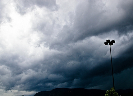
Blustery start to week in Kamloops, Okanagan; thunderstorms possible
Winds gusting up to 80 km/h are expected to hit the Kamloops and Okanagan regions today, April 18, and tomorrow. The strongest valley winds are forecast by Environment Canada to hit Penticton with gusts up to 70 km/h tonight. Wind gusts of up to 50 km/h are expected in the rest of...
 Valandos
Winds gusting up to 80 km/h are expected to hit the Kamloops and Okanagan regions today, April 18, and tomorrow.
The strongest valley winds are forecast by Environment Canada to hit Penticton with gusts up to 70 km/h tonight. Wind gusts of up to 50 km/h are expected in the rest of the region.
Winds could be even worse in mountain passes with the Okanagan Connector forecast showing gusts up to 80 km/h tonight.
There is a 30% to 40% chance of showers in the region today and 40% chance tomorrow, along with the risk of thunderstorms tomorrow afternoon.
The good news is temperatures are expected to be in the normal range for this time of year, meaning highs of 12 Celsius and 14 C in the Okanagan early in the week and 13 C to 16 C in Kamloops.
Lows may still dip below freezing overnight.
Wednesday is forecast to be sunny but that’s followed by a 60% chance of showers on Thursday.
The Coquihalla Highway from Hope to Merritt is showing a range of showers, snow flurries and snow, depending on elevation. Five to 10 centimetres of snow are forecast for late tonight along with winds gusting up to 70 km/h. Snow is expected to continue into late Tuesday afternoon with another five cm likely to fall.
The Coquihalla Highway from Merritt to Kamloops is expected to only get about two cm of snow tonight but winds could gust up to 70 km/h after midnight.
The Okanagan Connector is forecast to get two to four cm of snow tonight with winds gusting up to 80 km/h.
Environment Canada issued a special weather statement as a late season snowfall is expected in the Rogers Pass on the Trans-Canada Highway and the Kootenay Pass on Highway 3 today through to tomorrow. Roughly 15 to 20 cm of snow is expected in a late season snowfall.
For the latest on highway conditions go to Drive B.C. here.
To contact a reporter for this story, email Rob Munro or call 250-808-0143 or email the editor. You can also submit photos, videos or news tips to the newsroom and be entered to win a monthly prize draw.
We welcome your comments and opinions on our stories but play nice. We won't censor or delete comments unless they contain off-topic statements or links, unnecessary vulgarity, false facts, spam or obviously fake profiles. If you have any concerns about what you see in comments, email the editor in the link above.