Unseasonably warm weather in Okanagan, Kamloops continues this week
Unseasonably warm weather will continue this week in Kamloops and the Okanagan with temperatures possibly reaching double digits on the weekend. Average temperatures for today, Feb. 7 in Kamloops range from a daytime high of 2 Celsius to an overnight low of -5.4 C. Today’s high for...
 Valandos
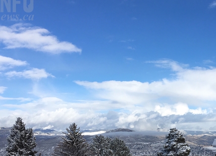
Unseasonably warm weather will continue this week in Kamloops and the Okanagan with temperatures possibly reaching double digits on the weekend.
Average temperatures for today, Feb. 7 in Kamloops range from a daytime high of 2 Celsius to an overnight low of -5.4 C.
Today’s high for Kamloops is forecast to be 7 C with an overnight low of -2 C. According to the Environment Canada forecast, daytime highs will be well above freezing all week, in the 5 C to 7 C range but hitting 10 C on Saturday.
The will be mostly a mix of sun and clouds but a 40% chance of wet flurries or rain tomorrow.
The website doesn’t post average temperatures for Kelowna or Vernon but they are generally close to the Kamloops readings.
The forecast highs for the Okanagan are in the 5 C to 7 C range with the coolest day being Saturday at 4 C. Overnight lows range are in the -2 C to -4 C range most nights with a mix of sun and cloud.
There’s a 40% chance of showers overnight Tuesday.
Penticton’s posting on the website shows an average high for today of 3 C and an average low of -3.5 C but its forecast is pretty much the same as the Central and North Okanagan.
READ MORE: 1 dead, 2 injured in several avalanches near Pemberton
Periods of snow are expected today on the Coquihalla Highway from Hope to Merritt today with accumulations of five to 10 centimetres and snow levels rising to 1,200 metres. The snow level will fall to 500 metres with a chance of flurries tomorrow with gusty winds.
From Merritt to Kamloops and from Merritt to West Kelowna, it’s expected to be mainly sunny and windy today with a chance of flurries overnight and a chance of rain showers Tuesday afternoon.
Highway 3 from Hope to Princeton is expected to be mainly cloudy with 60 percent chance of flurries. Snow level is expected to rise to 1,000 metres this afternoon with gusty winds. There’s a 60% chance of flurries overnight with the snow level reaching valley bottoms Tuesday with gusty winds.
Up to five cm of snow is expected on Highway 1 through Eagle Pass to Rogers Pass with the snow level near valley bottoms with gusty winds. There’s a 30% chance of flurries overnight and tomorrow.
Alpine snow base on local ski hills:
- 186 cm – Sun Peaks
- 155 cm – Silver Star
- 162 cm – Big White
- 164 cm – Apex
To contact a reporter for this story, email Rob Munro or call 250-808-0143 or email the editor. You can also submit photos, videos or news tips to the newsroom and be entered to win a monthly prize draw.
We welcome your comments and opinions on our stories but play nice. We won't censor or delete comments unless they contain off-topic statements or links, unnecessary vulgarity, false facts, spam or obviously fake profiles. If you have any concerns about what you see in comments, email the editor in the link above.